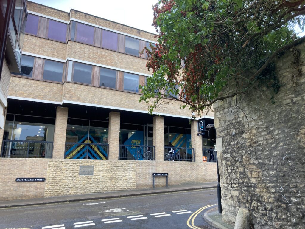
The Turf Tavern still retains its quaint charm, despite long being discovered as a tourist destination. Found down a narrow cobbled alleyway, it advertises itself as the oldest pub in Oxford (The Bear might argue with this) and as the establishment where Bill Clinton ‘didn’t inhale’ (disputed). But in truth its most interesting feature I only discovered recently. The high stone wall dominating the garden is not there to keep unruly students out, but is one of the few intact stretches remaining from the old medieval city defences (well, a city after 1546 when the town was made a see). I was curious to know whether there was more secret sections of ancient stonework to be discovered.
So on a sunny September day, contributing photographer John Milnes and I were excited to join a walk around what is left of the old fortifications that once ringed the town. It was organised by the Oxford Preservation Trust, as part of their Open Doors weekend and led by one of their trustees, archaeologist Julian Munby. However due to time constraints we didn’t manage the whole two miles of it, so John and I, taking An Historical Map of Oxford as our guide (published by the Historic Towns Trust) set off to circumnavigate it again, with the flexibility of being able to nose around in colleges, and climb towers and bridges to find the bits we missed. Today’s post is a sort of virtual walking tour, and as the keen eyed amongst you will spot from the pictures, a mix of both trips showing the glorious blue sky of early autumn, as well as the wet weather that has now taken hold.
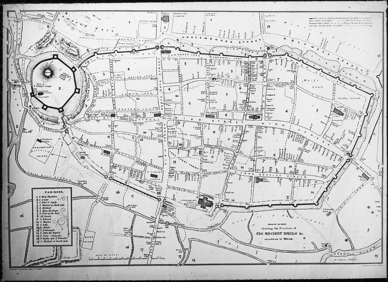
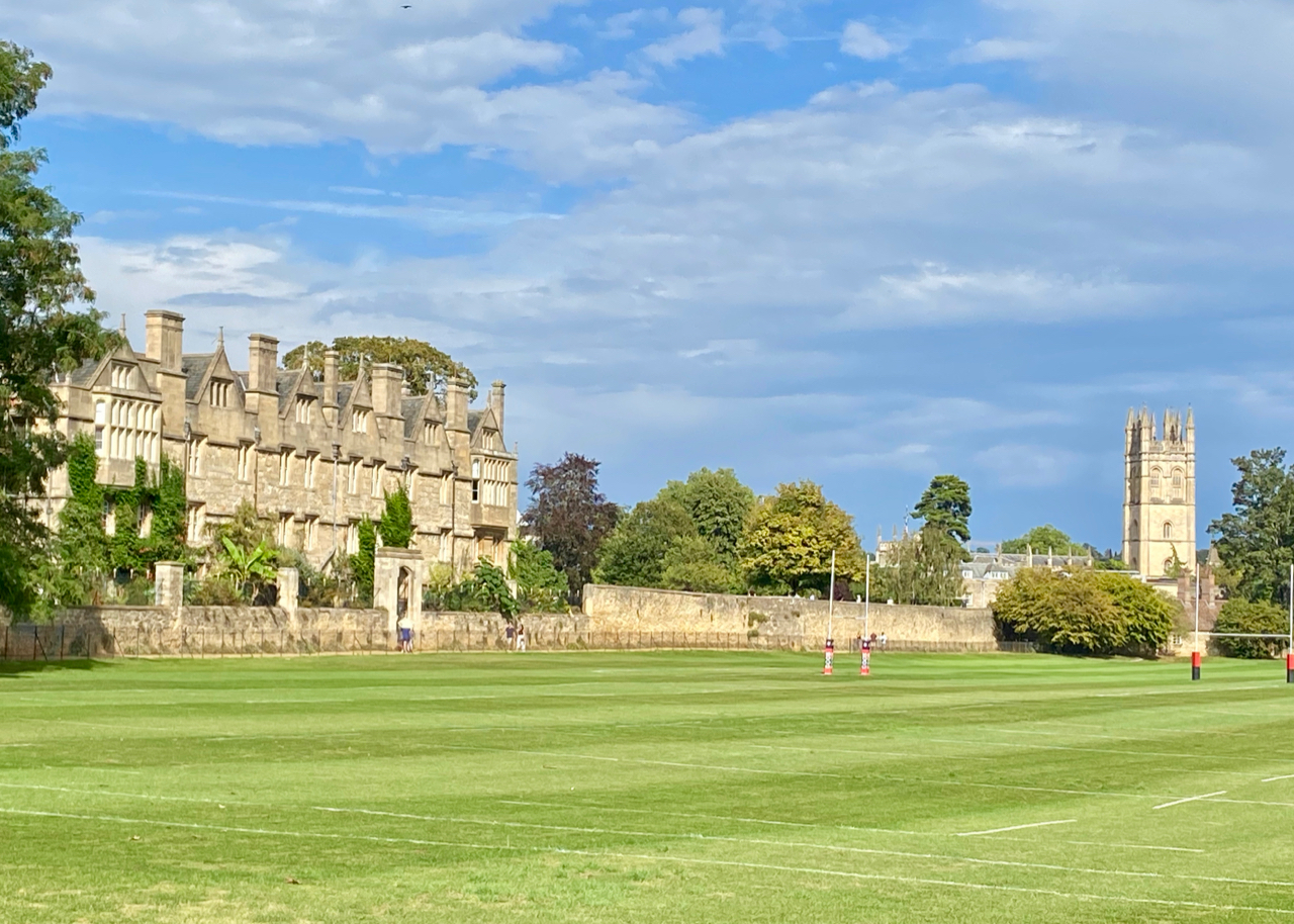
Clutching our map (which for reasons of copyright I cannot reproduce, but the one above shows where the old medieval town stone wall would have once stood) we could see that geography was all important in determining where the defences needed to go. Oxford is built on the confluence of two rivers, The Thames and its tributary the Cherwell, which means water meadows surround the settlement on three sides, leaving only the north of the city really vulnerable. The 13th century wall pretty much followed the line of its Anglo Saxon predecessor, huge earth ramparts topped with a timber palisade. These had been erected by King Alfred in the 9th century, as one of a string of ‘burghs’ to ward off invasions by the Danes. It was the Anglo Saxons who were the first town planners, creating four main gates at which they charged tolls, allowing traffic to converge at a central crossroads, Carfax, (from the Latin ‘quadrifercus’, meaning four forked) still at the heart of Oxford today. The new blockade had 21 bastions built into it, as well as three smaller gates. Where were they in the melee of modern Oxford? The Oxford Sausage, was turning super sleuth, to see what we could uncover.
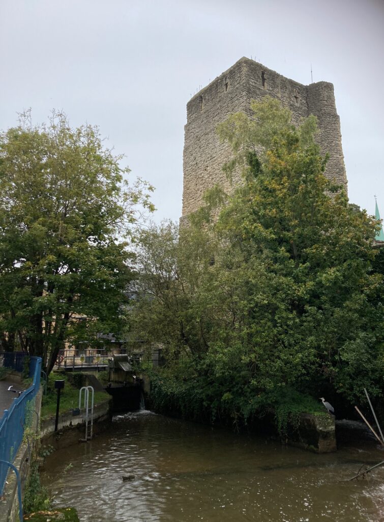
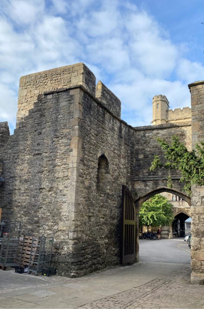
We start on the west side at St George’s Tower, older than the Norman Castle built in 1071, but amalgamated into it at that time. This impressive structure must have once dominated the city. Now it’s pretty much all that is left of the old Oxford Castle, that was first an administrative stronghold, then a prison and now part ‘visitor experience’, part boutique hotel. It has walls nine feet thick, and is protected on the south and south west by the Castle Mill stream and Trill Mill stream. It is from one of its top windows that Empress Matilda, (who should rightly have become England’s first Queen) escaped while under seige from her cousin King Stephen in 1142. On a cold December night, dressed only in a white nightdress which camouflaged her against the snow that lay deep on the ground, she let herself down on ropes and escaped across the frozen river to safety in Abingdon.
Traditionally it was around the castle, that the poorest lived and so their homes were easy prey for developers. Instead of rows of small cottages, we now have a gargantuan shopping centre, offices and great scars of roads cutting through this part of Oxford. Above is a view of Bulwarks Lane, a quick short cut from Castle St to George St but closed at the moment for yet more building work. It was originally Bullocks Lane named after the man who collected rubbish and dung from the city and dumped it here. Despite its modern spelling, this is not the city wall, but you can just see the gate at the top. This is where it would have veered north, away from the castle compound.
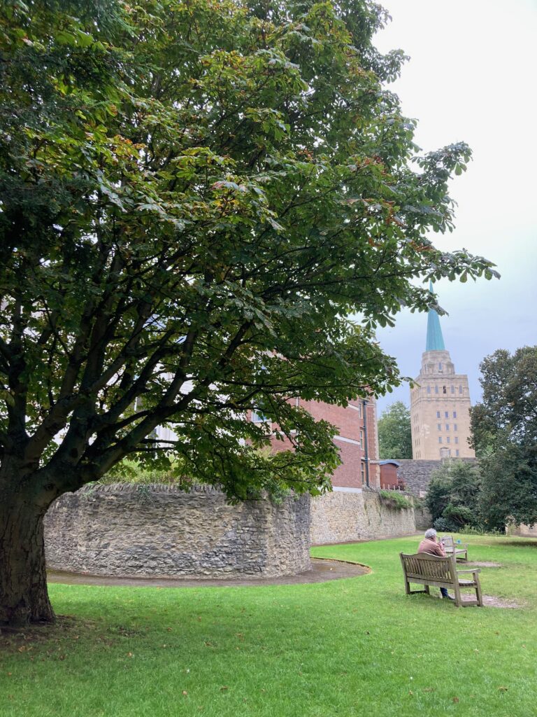
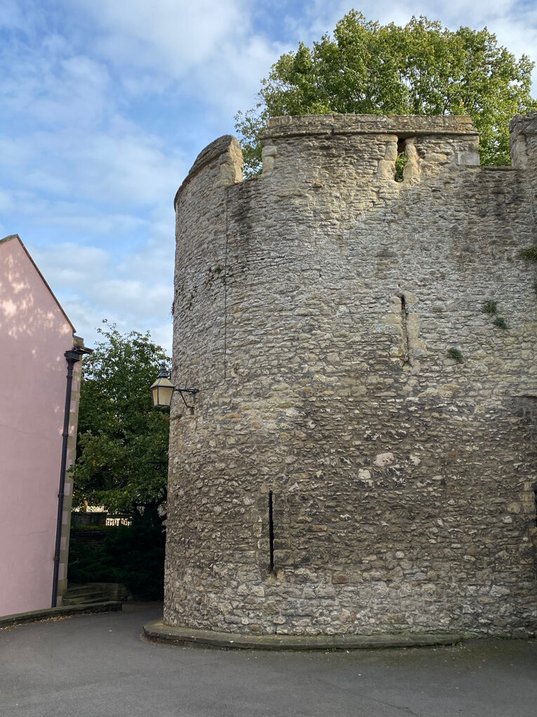
Left into New Inn Hall St, and then through a cramped nondescript carpark, sandwiched between the Wesley Memorial Church and a dry cleaning shop . Through a gate at the end and we find ourselves suddenly transported into a large open space. It’s the garden of what is now the University’s History Faculty Library. And here we find our first bastion, hiding in the shadow of the 100 feet copper topped spire of Nuffield College. Overhung with ivy, it must have been a great talking point for history teachers at what was once the Oxford School for Boys which counts the comedian Ronnie Barker and Lawrence of Arabia as alumni.
Leftover evidence of a hard night’s study was all that was on show when we visited. But this is believed to be the spot where the Levellers Stephen Biggs and Roger Piggen were bought from Oxford prison after being court-martialed for mutiny in Cromwell’s New Model Army. Here, on 18 September 1649, they were shot, and their bodies unceremoniously carted along the outside of the city walls to the church of St Mary Magdalen where they are recorded as being buried.
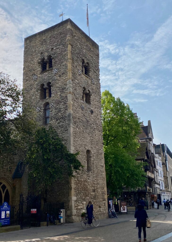
Down St Michael’s St and our next stop is the church of St Michael of the Northgate, which as the name suggests once formed part of the north gate into the town. The tower is thought to be the oldest building in Oxford, erected before the medieval walls and incorporated into them. There would have been churches at each of the main gates. This one, now the city church, is the only one still in regular use for worship. It’s a peaceful place away from the bustle of central Oxford, but steeped in history. This is where the Victorian poet and designer William Morris married his muse, Jane Burden, and where you can find the font at which William Shakespeare discharged his duties as godparent to his godson (or if you believe the rumours his son), William Davenport.
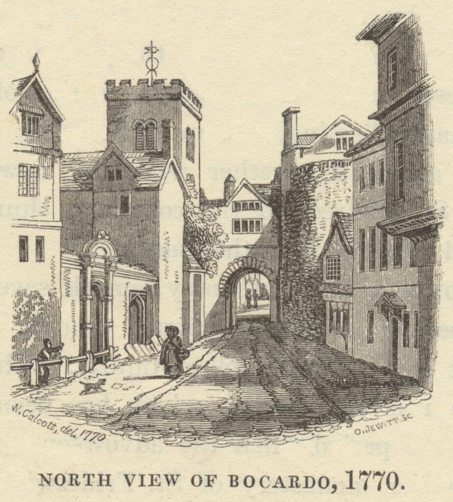
Writing in the late 1600’s the Oxford historian Anthony Wood describes what it might have looked like in its early days: ‘This was the strongest gate of the city; as indeed by good reason it should, having no river before it. It was well strengthened on each side with a strong, bulky tower; and backed on with another gate, with a port-cullis to let down before; and also a military engine erected over it, through which they could cast down anything obnoxious to the enemy approaching. Such a gate so strengthened was called “porta macho-collata”, which was a passage over it like to a grate through which scalding water or any other weighty substance may be cast upon the assailants.’
By the 14th century it was also being used as a prison, the Bocardo, a word meaning a difficult trap to escape from. It is here in that the three Protestant martyrs, Thomas Cranmer, Hugh Latimer and Nicholas Ridley were incarcerated before being taken outside the city walls to the ditch, now Broad Street, where they were burned at the stake, during the reign of the Catholic Queen Mary.
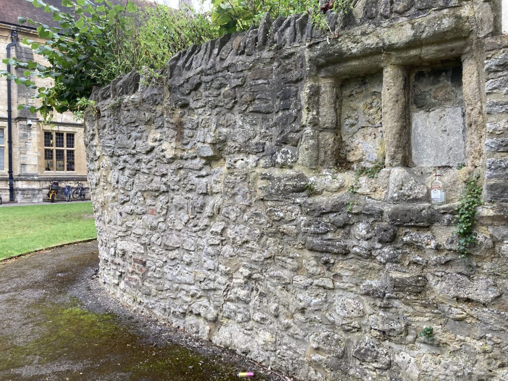
Walking down Broad St, you will often see groups of people huddled around a brick built cross. This marks the spot where the burnings took place. All public executions were conducted outside the city walls. Latimer and Ridley were executed as heretics in October 1555. It took another five months to condemn Cranmer, but it is said he was led from his prison cell to a bastion that stands in a private garden behind this row of shops. Now named ‘the martyr’s bastion’ it was here he was made to watch his friends suffer. The following year he was burned to death on the same spot.
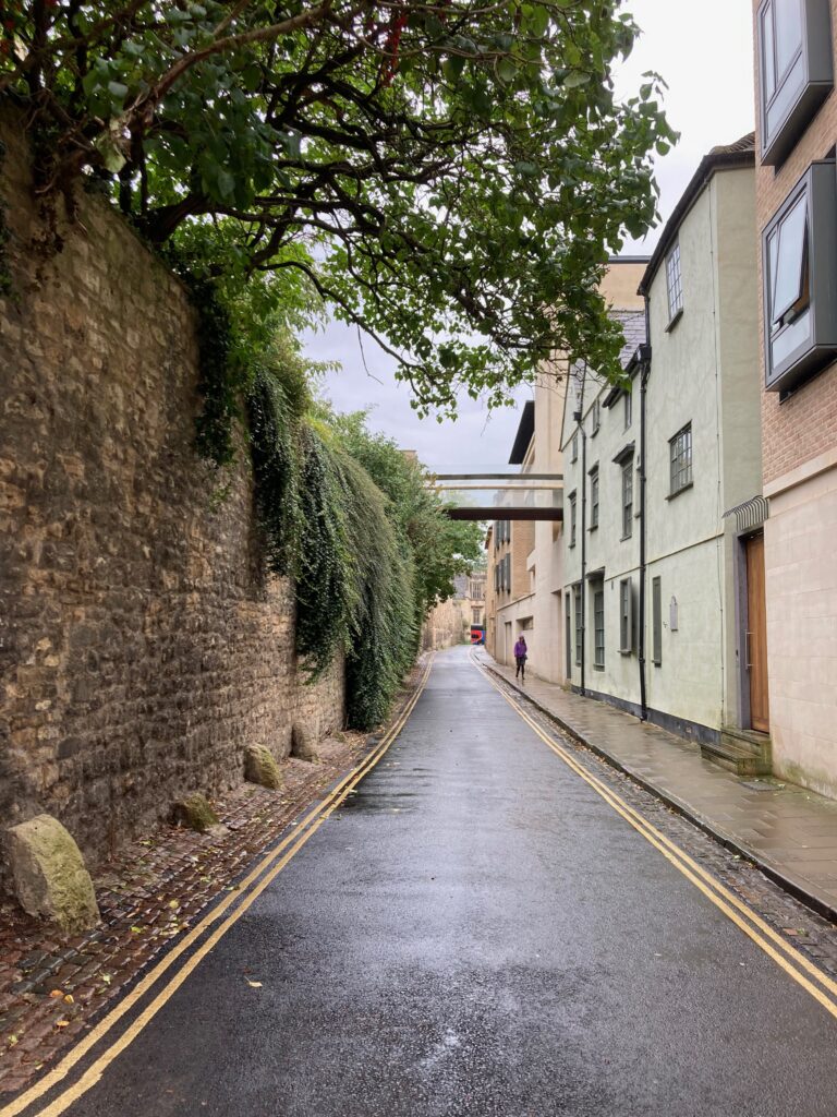
Broad St, once a place of execution and horse mongering, is now a refined mix of colleges, cafes and bookshops. But John has heard there’s a piece of wall lurking down a secret passageway.
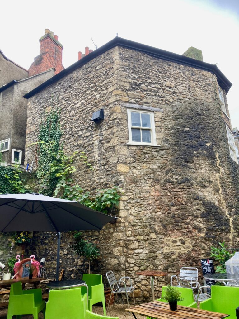
And sure enough, here we find another bastion. I have lived in Oxford most of my life and I had no idea.
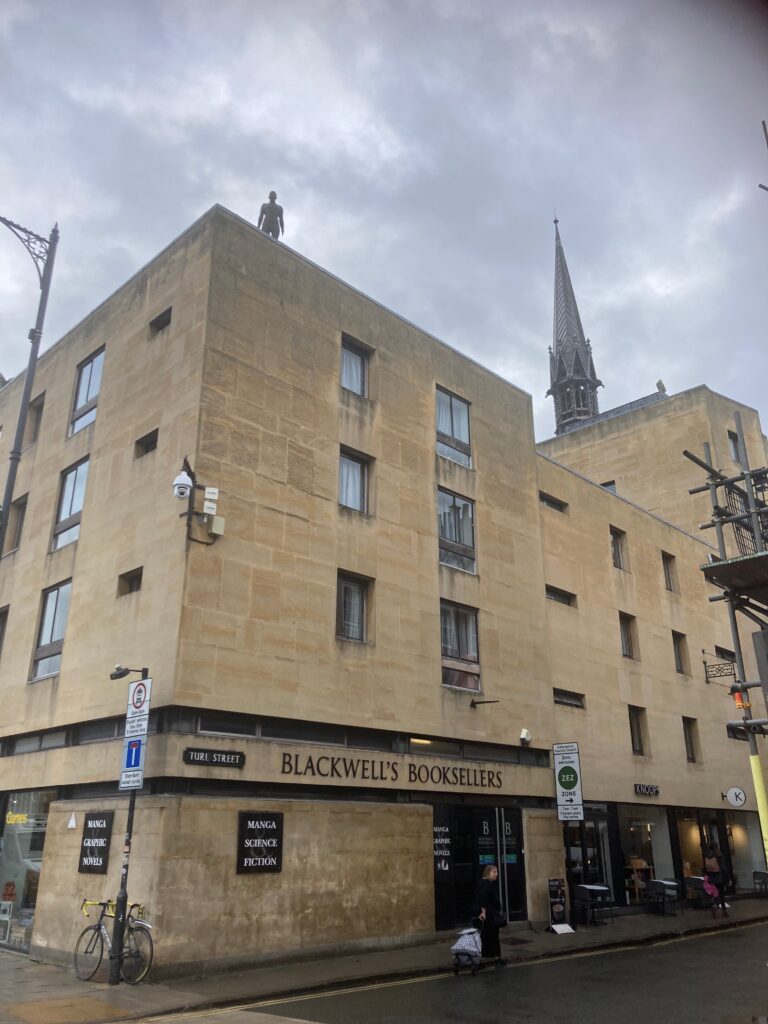
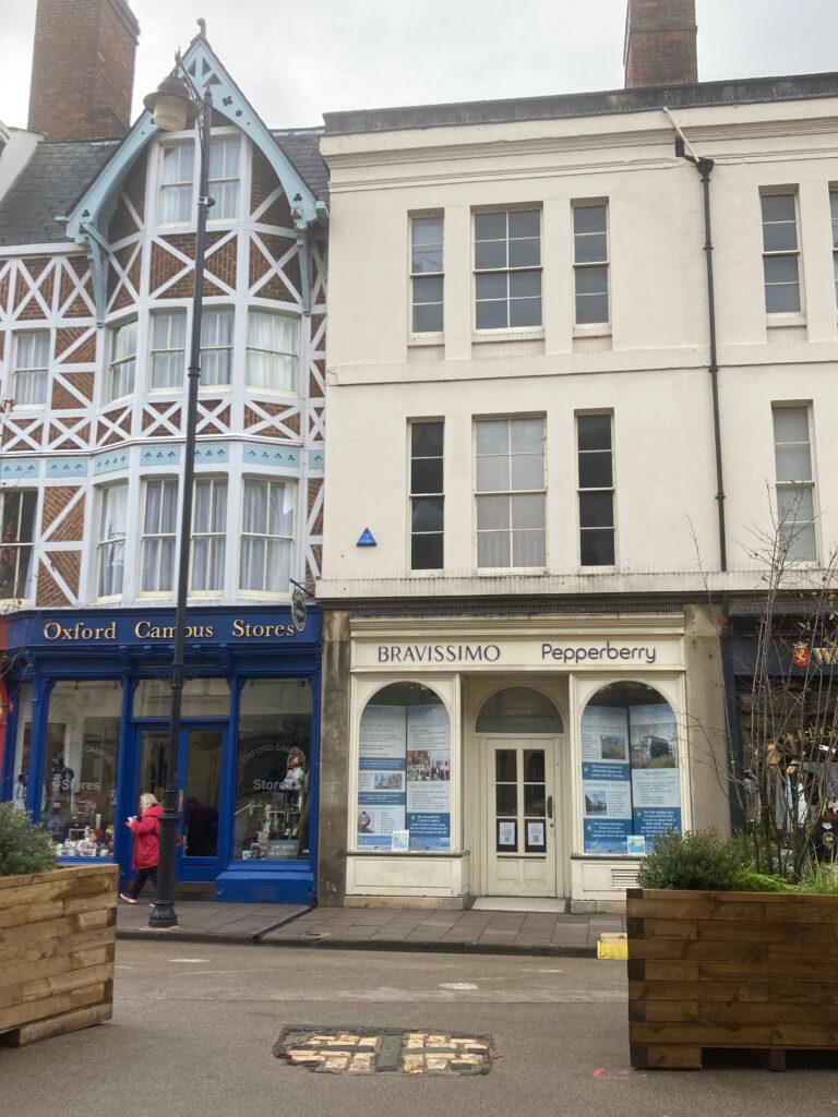
But there is no time to dawdle. Further along Broad St, we meet a turning to the right, Turl St. The name is a shortened version of ‘twirling gate’, a small gap in the wall designed so that people not cattle could gain access. There’s nothing left bar the name, but look up. In most parts of the city you will be rewarded by a glimpse of a spire, an interesting weather vane, or a statue of a notary positioned as near to heaven as they could get. Here you will see a seven foot naked statue by Antony Gormley. He looks like he is contemplating jumping but I have watched him often enough now to know that he has decided against it.
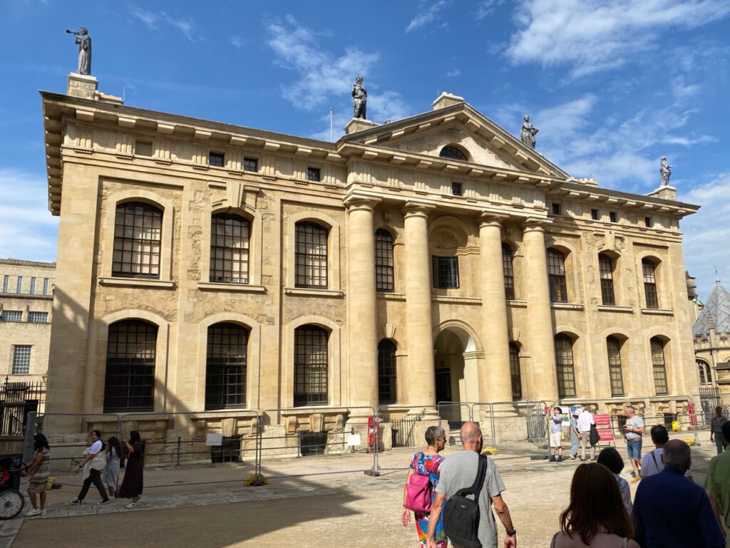
At the end of Broad St we reach the heart of the University buildings, the Clarendon building (above) built to house the Oxford University Press, the Sheldonian Theatre and the magnificent Bodleian Libraries.
Tram lines mark where the wall would have run along towards Catte St.
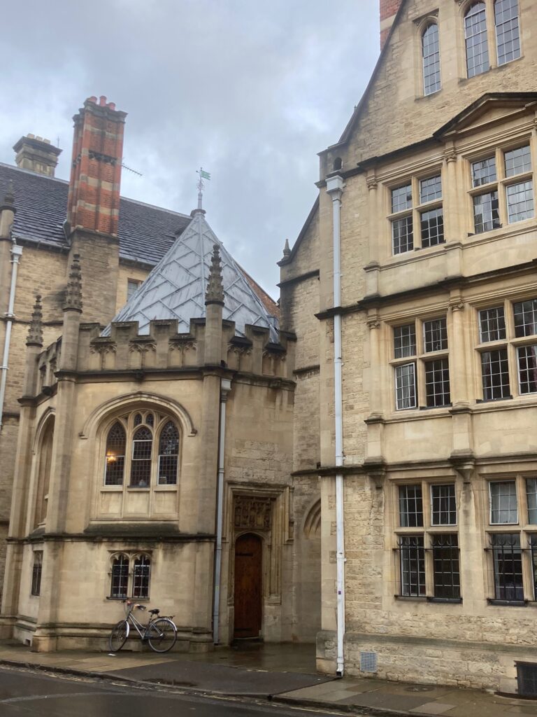
And here there would have been another small gate, Smith Gate. I’ve often wondered about this charming octagonal building, but now I know that this was once the chapel of St Mary the Virgin, probably just outside the city wall. Students would have come here to pray for divine intervention before heading to take their exams in Divinity Schools across the way. The 16th century stone carving above the door to what is now Hertford College Middle Common Room, still remains having escaped the desecration of the Commonwealth years.
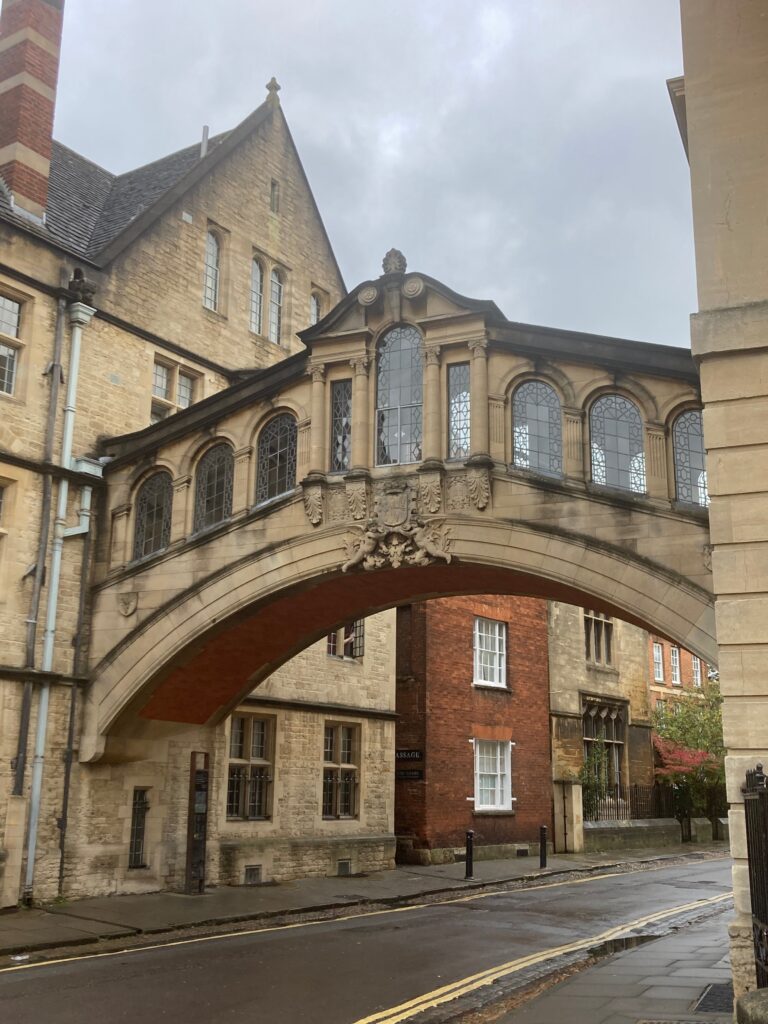
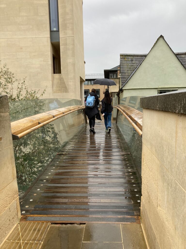
Onwards and still on the north side of the city, we walk under the Bridge of Sighs (which incidentally looks nothing like its namesake in Venice and was built so students at Hertford didn’t have to mix with the riff raff while crossing from one part of the college to the other). A sharp turn down a narrow passage, takes us…..
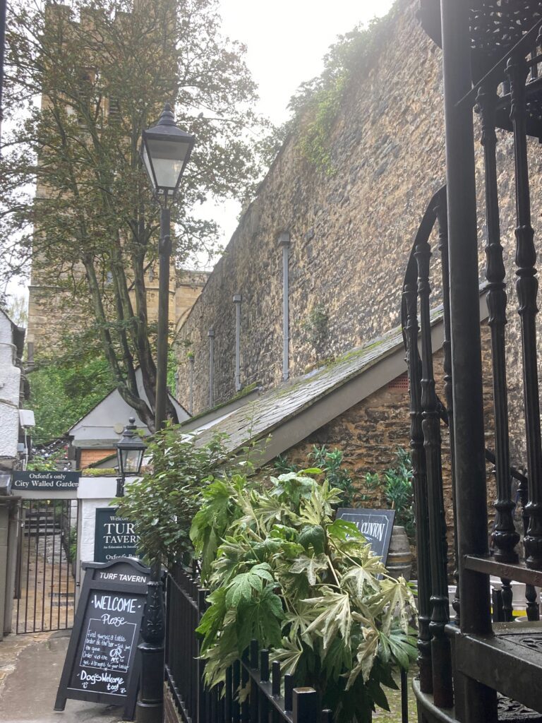
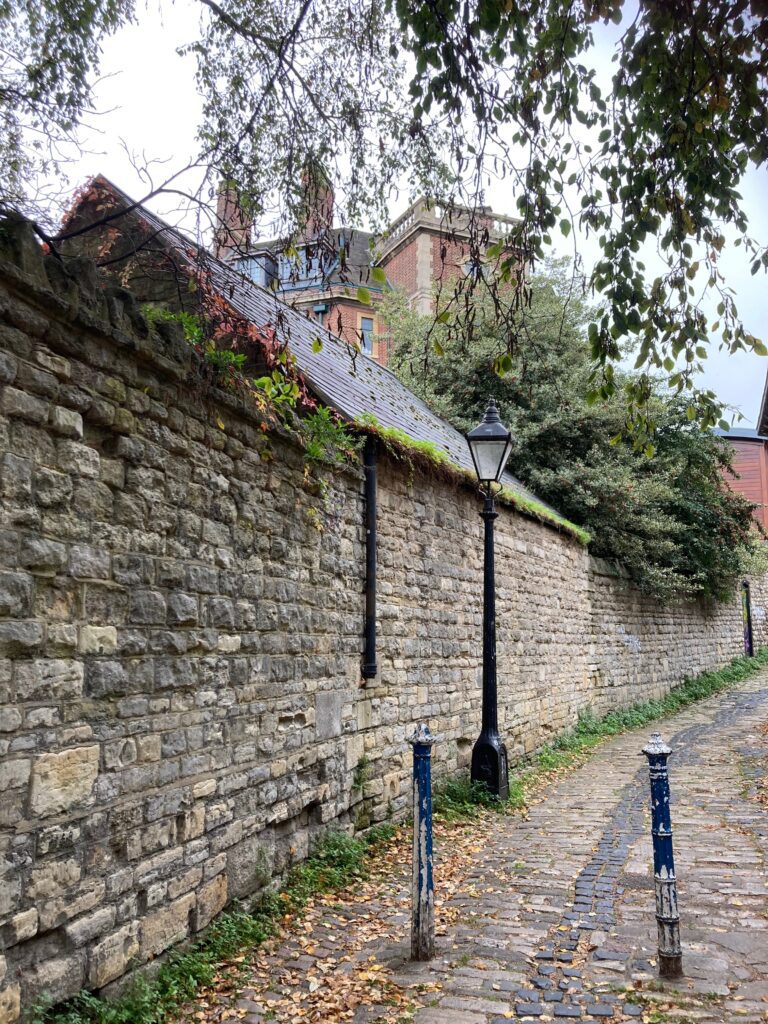
…to the Turf Tavern, once called the Spotted Cow. It changed its name once its reputation for gambling took hold, which was not allowed within the city walls. No time for a swift pint though as we are eager to see what is on the other side. This you can do only by entering New College, (for which you must either pay a fee or claim to be visiting the chapel), but it’s well worth it. New College is hardly new now, as it was built by William of Wykeham, Bishop of Winchester, in 1379, and is one of Oxford University’s grandest foundations.
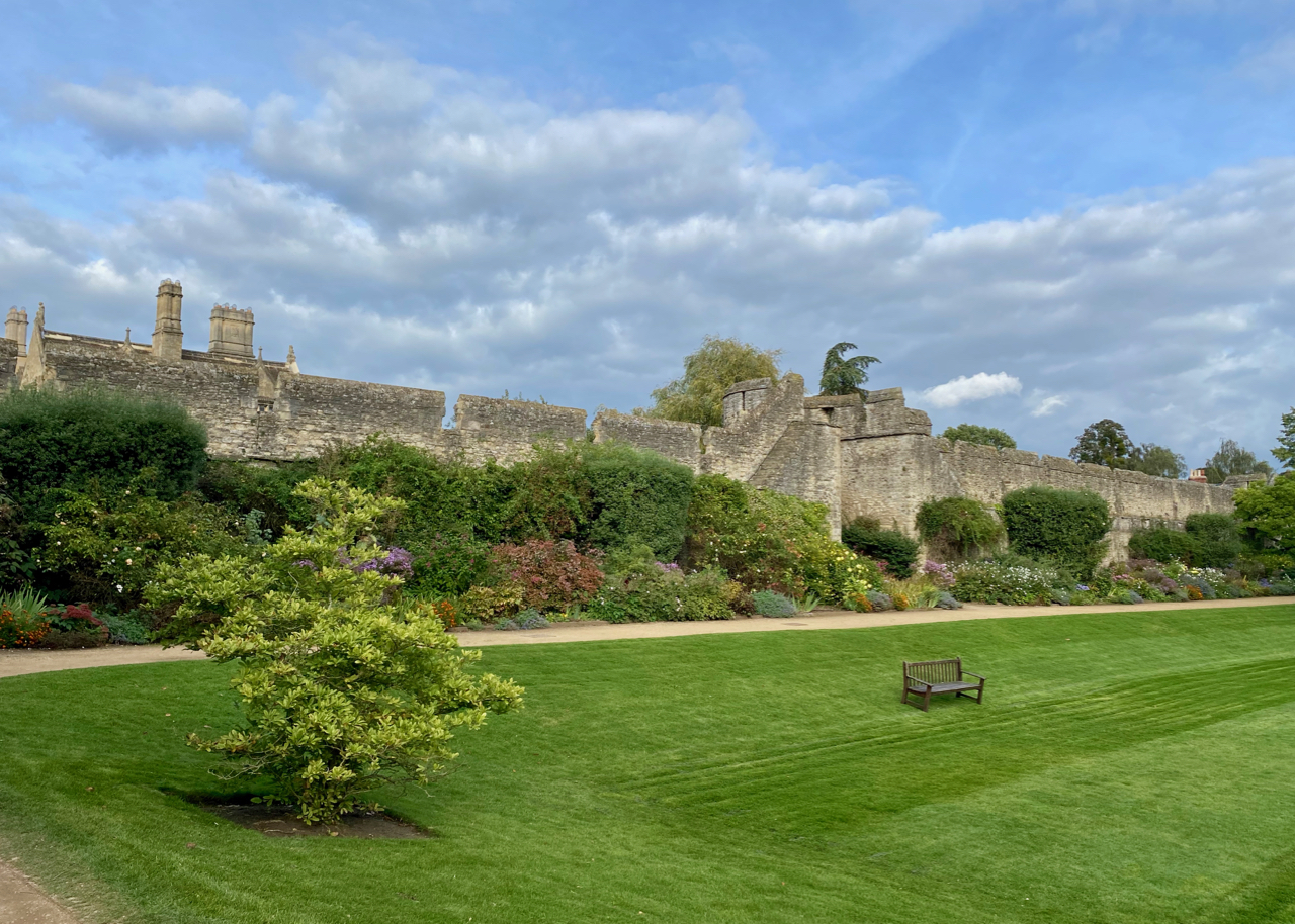
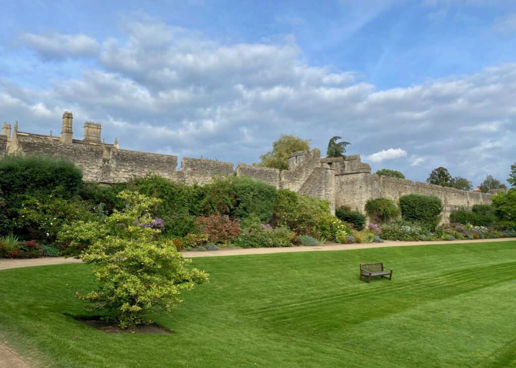
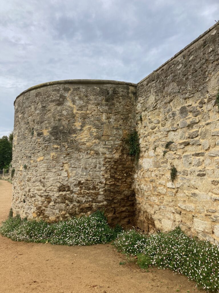
And it is magnificent. Here we find one of its five bastions, beautifully preserved standing next to where the college choristers rehearse for evensong. Actually the whole length of the wall in New College is in immaculate condition. And there’s a reason for this. After the Black Death of 1348, the land here had become derelict. Well over half the population of Oxford was wiped out, leaving houses deserted. Owned at this time by the City of Oxford, Wykeham was able to buy the land cheap. With one proviso. He keep the city walls in good repair. And so he did. Indeed to this day, every three years, The Lord Mayor of Oxford and a group of city councillors still enter the college and climb the city walls to inspect their upkeep. It remains one of the best preserved stretches of city walls in the country.
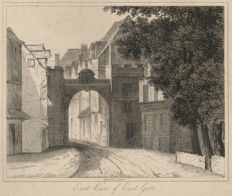
From New College, the wall turns suddenly due south. So leaving the spacious grounds of Wykeham’s foundation, we head back out into the city traffic towards what was once its East Gate.
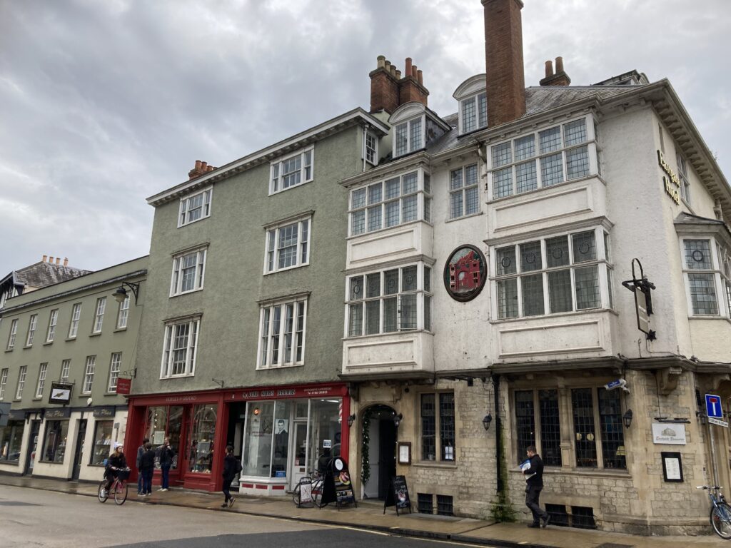
A hotel bearing its name, standing at the start of the High St, is the only reminder of what once stood here.
But here Julian recounts an interesting story. For this, he believes, is the location which Chaucer used to set his ‘Miller’s Tale’. I leave it to him to take up the tale.
‘Thomas Chaucer demonstrates a familiarity with Oxford in the Canterbury Tales that has led some to suggest that he may have attended the University. In the Miller’s Tale, the scene is set in the house of John, an Oseney carpenter and his wife Alison. She is pursued by the lodger, a student called Nicholas, and also by the parish clerk Absalon, with the comic/indecent denouement in which Nicholas is branded on the backside by Absalon in circumstances that do not need to be further described here. Whether or not the story was complete fiction, there are reasons to suppose that the events in the tale can be located with some certainty.
Building tradesmen were generally to be found at the lower end of High Street, and there was a large Oseney property on the site of the ‘Eastgate Hotel’. So an Oseney carpenter was most likely to be found around there. Moreover, the medieval forges of Oxford were outside the gates, and there was certainly one at North Gate and one at East Gate (just like modern petrol stations are to be found on exit roads from towns).
It has always been assumed that the forge at the East Gate was the Hospital/Magdalen property on the west side of the Longwall corner, but the discovery of forge material on the east side of the corner raises the possibility that there was another one there that could equally have been used by Absalon to heat up his branding iron. But from whichever fire it came, it is pleasing to imagine that this scene was played out close by.’
So now you know.
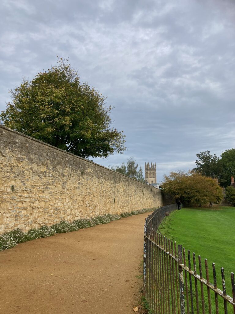
Down Rose Lane, through the kissing gate and we reach my favourite stretch of the wall. Meandering along the backs of Merton, Corpus Christi and Christ Church colleges, you have to rub your eyes to believe the open views south over the meadows, unchanged for centuries. The path is called Deadman’s Walk, as apparently it was the route taken in medieval times by Jewish funeral processions. Jews were not allowed to bury their dead within the city walls, so this is the journey they took to their cemetery, now under the Oxford Botanic Garden.
At this time of year its length is wreathed in swathes of pretty Erigeron. A plaque tells us that this is the spot where the pastry chef James Sadler became the first English aeronaut to make a successful ascent in a hot air balloon in October 1784.
It is also the place where the Royalist Colonel, Francis Windebank was bought by the Parliamentarians to be executed by firing squad during the English Civil War in 1645. He is alleged to walk here still, though his ghost can only be seen from the knees up as the ground is now much higher than it once was.
There’s nothing to be seen of the south gate to the city, lost long ago to widen the road for traffic coming from the south. But cross over from Christ Church and we enter Brewer St, finding ourselves back alongside the medieval wall, now overhung with ivy. This picture looks back towards Christ Church and shows the new glass bridge built by Pembroke College to link their two sites.
A kindly lady from the college allowed me to photograph what has been nicknamed the ‘Bridge of Thighs’.
Back outside and you can clearly see the arches in the brickwork once used for drainage.
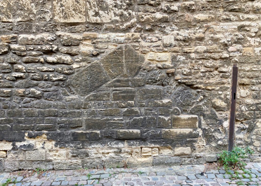
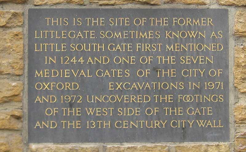
As the wall turns north again, there is one last glimpse of 13th century stonework. And a plaque where Little Gate once stood.
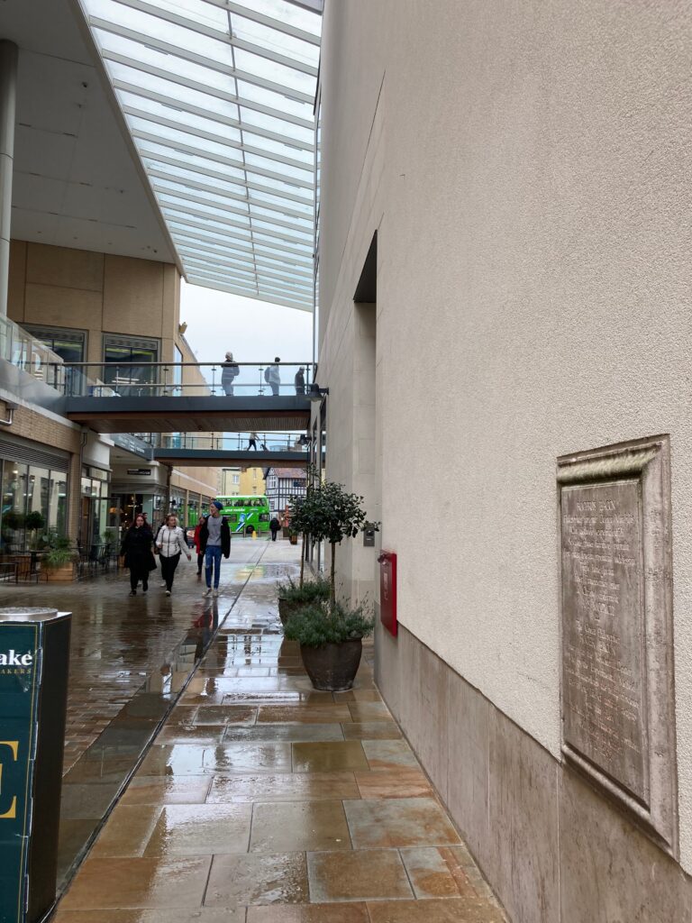
And that is just about it. The city have chosen to annihilate this part of our city’s heritage, and we have to walk through Westgate shopping centre, to return to St George’s Tower and the castle.
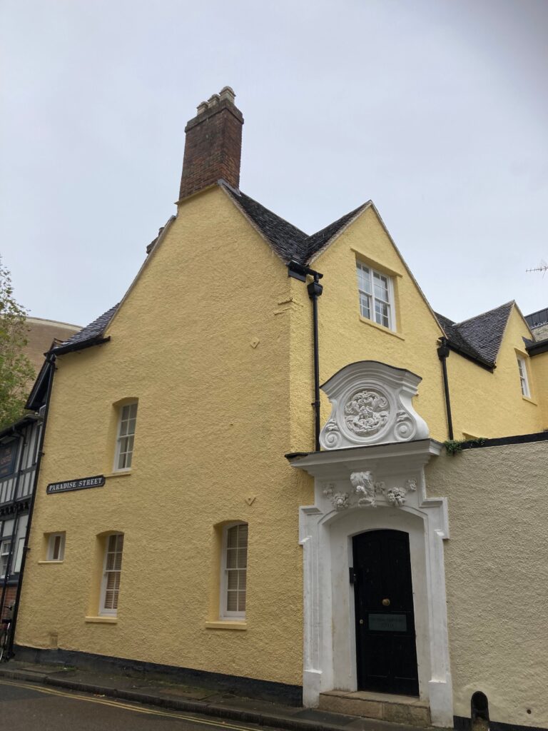
Here there are only street names like Roger Bacon Lane, (after the philosopher and alchemist from the time the town walls were being erected) and Paradise St, (once the gardens of the Greyfriars), that remind us of what has gone before.
But I have loved walking the walls. Though it seems the University rather than the City authorities have been the better caretakers, I had no idea how much of the medieval wall we can still see. Now all that remains is for us to have a well earned coffee and a slice of cake. And though it is nestled round the back of new Oxford with not an ancient brick in sight, Ole and Steen happen to serve what I consider the best bun in town, the cinnamon social. Every cloud as they say!
The historical maps and atlases are all here:
https://www.historictownstrust.uk/maps
If you would like to book an in person tour with The Oxford Sausage, then do get in touch.
3 Comments
Join the discussion and tell us your opinion.
Completely absorbing – Now I just want to do the walk myself!
Wonderful,I am an ex Pat now living in Georgia USA.My father was a Friars boy.Chaundys Place off Paradise Square.His old house is now the Westgate multi-story carpark !I went there as a boy before it was demolished.Very sad for my Dad.
[…] Walking the walls […]