I am staring at a vast map on the wall of the cavernous Blackwell Hall in the Weston Library, a stone’s throw from the centre of Oxford. How I could have missed this huge hanging in the hundreds of times I have walked in this space I have no idea. But today as if by some magic here I am, standing in front of it, taking it all in.
Transfixed.
For it stands 20 feet wide and 16 feet high. At a distance it looks like an enormous, unfinished jigsaw, a portion only of the border complete and chunks of the interior. But go up close and the picture is instantly recognisable as a map that shows the towns and villages, hills, rivers, and forests that stretch from the Cotswolds to London with Oxfordshire at its centre. Remarkable in its accuracy when you consider that not only was this produced almost 450 years ago at the end of the Tudor dynasty when cartography was in its infancy, but it is also woven. A unique tapestry map, exquisitely crafted out of thousands of strands of brightly coloured wool and silk, it was considered at the time ‘a thing of wonder and delight to the beholder’. And despite its missing pieces, it still is.
This is one of the four tapestry maps (as well as Oxfordshire there was Warwickshire, Worcestershire and Gloucestershire, of similar sizes) commissioned by Ralph Sheldon in the late 1590’s to hang together in the great hall of his refurbished manor house at Weston in South Warwickshire. An impressive panorama of the English Midlands. Which was the point. For they were designed to show Weston House in all its glory (once pictured on all the maps, though sadly long since devoured by moths in the one before me at the Bodleian) as well as the extent of Sheldon’s large landholdings and those of his friends and relatives. Being from an old Roman Catholic family (his father William had been four times MP and three times Sheriff of Worcestershire) was precarious in the new Elizabethan era when you could be hung drawn and quartered for adherence to the old faith, the map was intended to show how much he owned as well as how well he was connected. He even included the Royal Coat of Arms alongside his own. In other words, this was his way of displaying how powerful he was, his loyalty to the crown, as well as providing a bit of distinctive decoration, made for the pages of a 16th century ‘Interiors’.
It’s difficult to comprehend in our era of google maps how truly revolutionary these maps must have looked when they were first made. There was nothing like them at the time. Thought to have been modelled on the county surveys made by Christopher Saxton in the 1570’s and the first maps of their kind in England, we had no tapestry industry to speak of then either. They were more than likely woven by Flemish émigrés fleeing war in the Low Countries, under the tutelage of Richard Hyckes, himself a Dutch Master weaver and at one time, arras maker to the Queen. At a scale of 1:25,000 (the same as modern Ordnance Survey Explorer maps) this was no mean feat, taking four men over a year to make each one, only working during day to ensure the colours remained consistent, and not changed by candlelight.
But it is the picture book quality of the piece that I find so beguiling. For someone has taken the trouble to gain the local knowledge not included in Saxton’s maps but needed to create the beautiful, detailed 3D pictorial landscape of shimmering coloured threads, red, yellow, blues and greens of different hues that I am looking at today.
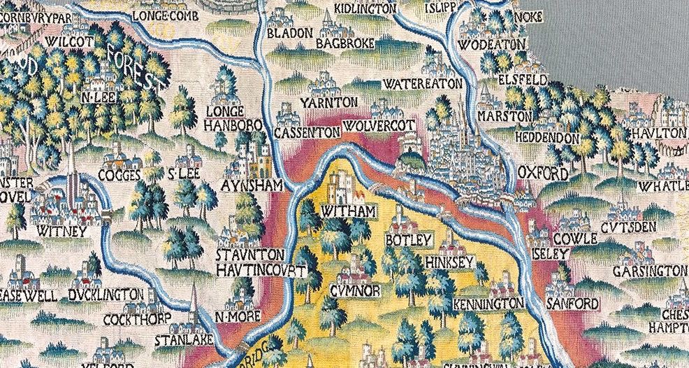
There is Oxford cradled at the confluence of the Thames and the Cherwell, with Magdalen and the bridge at Grandpont neatly woven in. The mound and the castle may dominate, but you can clearly make out the crockets on the spire of St Mary the Virgin and the tower of St Michael in the Northgate. There are the trees of Wychwood Forest leading to the flood plains around the Thames, the steep hills of the Chilterns, the gentle inclines of sheep meadows. There are large country houses like Wytham looking as it still does with its crenelated gateway and tall chimneys. And what were once the villages of Headington (Heddendon on the map), Marston, Botley, Hinksey and Cowley (Cowle), before they became integrated into the city sprawl, the names sometimes spelled slightly differently but reassuringly present. Witney is there, the spire at Standlake, Brightwell and Ewelme. I’d like to have seen Wallingford where I grew up, with its Norman Castle before it was destroyed in the Civil War but sadly that bit has been lost. It is the same place but different, definitely my world but from 400 years ago uncluttered by railways, motorways and acres of solar panels.
My favourite landmark on the tapestry is that of the White Horse at Uffington, a regular Sunday outing from my childhood. An abstract chalk horse carved into the side of a hill during the late Bronze Age, here it is portrayed as a wonderful old white carthorse, champing at the bit and ready to charge off across the southern slopes of the Downs. That and London Bridge, then crammed full of houses leading to the old St Pauls before Wren rebuilt it after the Great Fire in 1666 and gave it the now famous dome. Oh and Hakeney, the 16th century tower of St Augustine (just behind where I lived in the 1980’s) standing high above the red roofs of what were then wealthy homesteads surrounded by fields built for weekenders from the city.
By 1781 the Sheldon family had fallen on hard times, and the contents of their houses sold off. Ralph’s tapestry map of Warwickshire is the only one of the four to survive completely intact, now owned by Warwickshire Museum Services. But I think he would have been pleased that much of what is left of the others has ended up at the Bodleian. For Thomas Bodley was a friend of his, to whom he gave £50 towards the design of a new library in Oxford. And although an icehouse is now all that remains of Ralph’s great country estate at Weston, it seems apt that his wonderful map of Oxfordshire has found its way to the vast hall of the Weston Library. From Weston House to Weston Great Hall. I think he would have approved.
I am just about tear myself away when an elderly couple come to stand next to me. They tell me they live in Garsington and are wondering if they might spot the place on the map. “There it is,” I say, pointing to the name, woven in black thread beside a small cluster of houses topped by a square church tower, separated from Cowle(y) by a small incline of green. “Not much different to now,” she smiles turning to her husband her face filling with emotion. “What a lovely surprise.”
And that is exactly what it is.
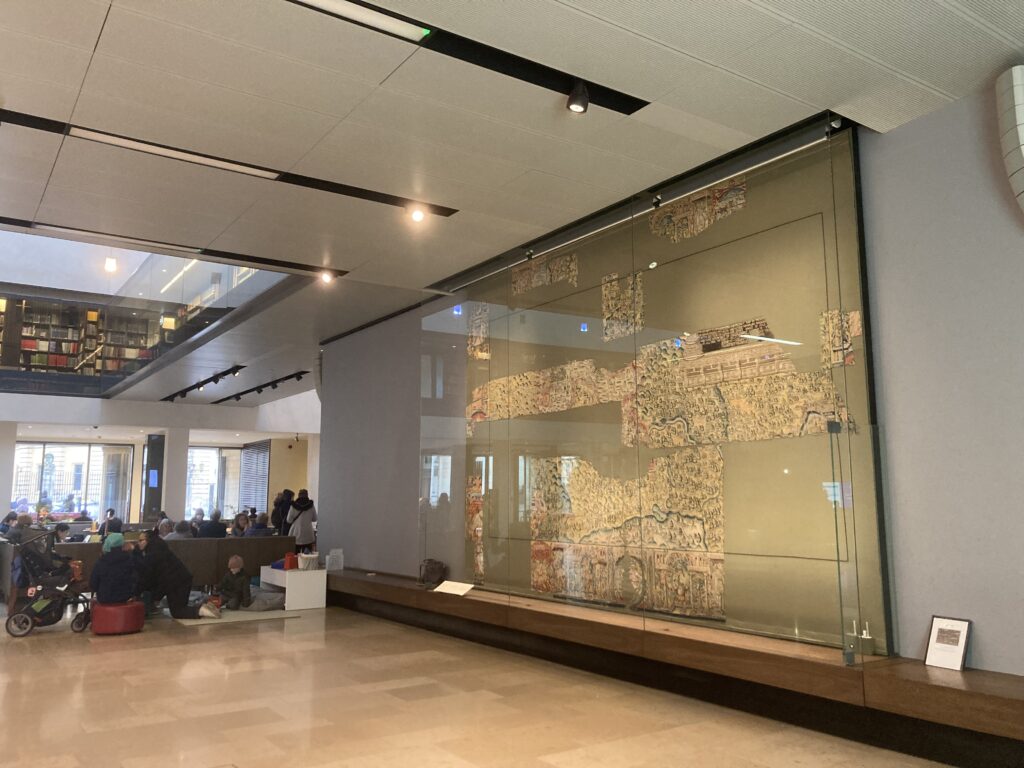
Blackwell Hall at Weston Library, home to the special collections of The Bodleian. The ground floor pictured above is open to everyone.
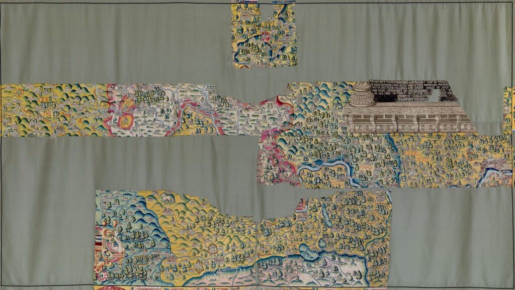
The surviving part of the Oxfordshire map. The writing (top right) states that there were 16 colleges and 8 halls in Oxford at the time it was made, dating it to between 1579 and 1610.
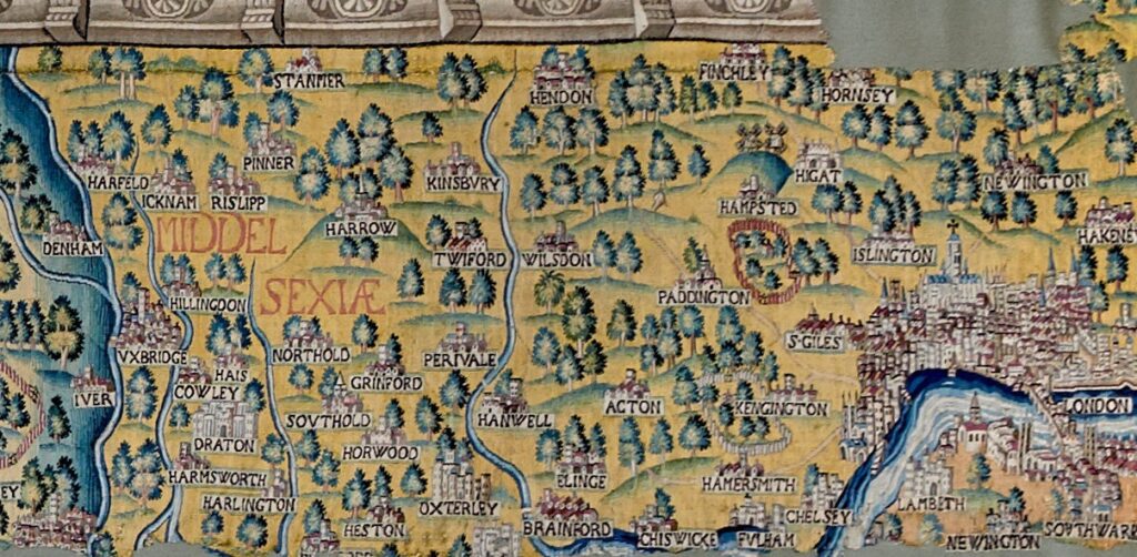
Middlesex (Middelsexiae) with London on the right. There is London Bridge, St Pauls (before Wren rebuilt it with a dome) and the Tower of London with its White Tower.
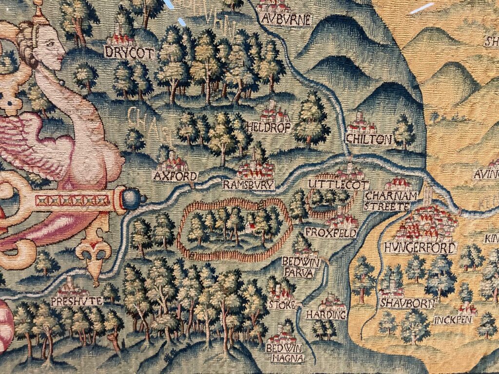
Country houses are often recorded on the map surrounded by high fencing.
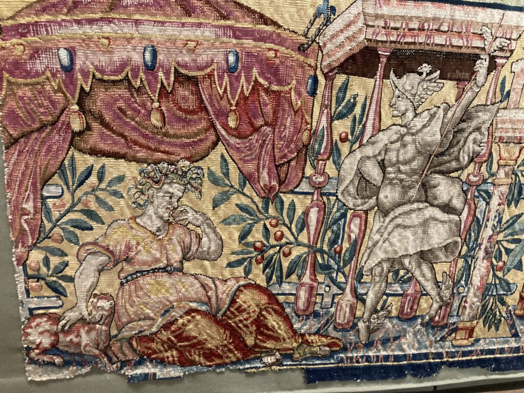
Part of the surviving border to the Oxfordshire map shows Mercury with his winged shoes and hat, God of communication, trade and travel, looking on as Envy devours a human heart.
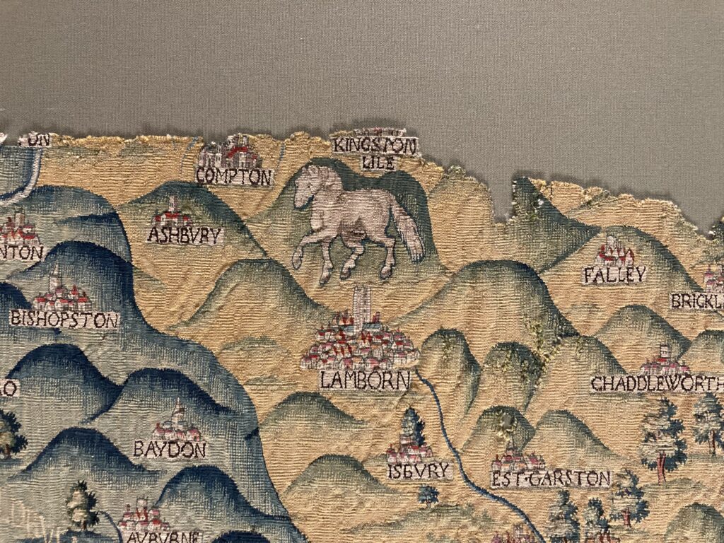
The White Horse at Uffington, a prehistoric hill carving, seen here as a spirited carthorse.
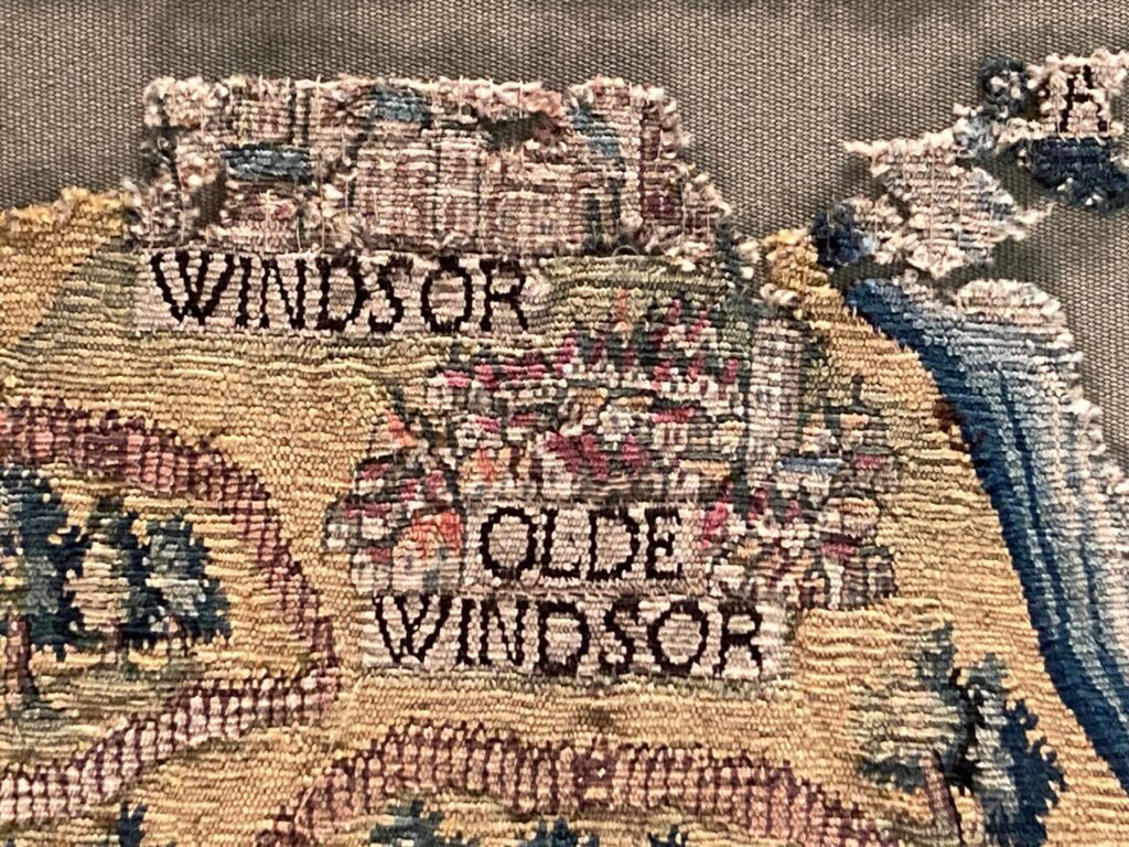
Windsor Castle had belonged to the monarchy since Henry 1’s day in the 12th century. It was a favourite residence of Elizabeth 1.
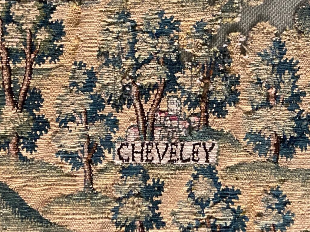
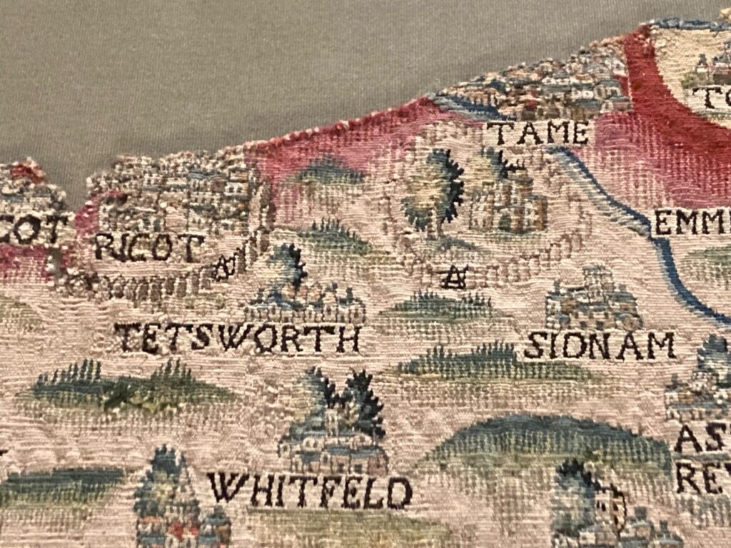
There was a house at Ricot (now Rycote Park) from the 13th century, but it was a magnificent palace in Tudor times much visited by royalty. The 15th century chapel still survives.
5 Comments
Join the discussion and tell us your opinion.
I often walk past the Weston without going inside but this is now my number one destination. I have to have a really good look at the map and find the places I remember best – Wheatley, Horspath, Shotover and the Olde Road to London where highwaymen lurked behind the hedgerows. Not that I encountered the highwaymen but Sheldon must have.
Fascinating! I’ve been inside the Weston, but like you hadn’t noticed the map. I’ll make a special trip to see it now. It’s thrilling to see familiar place names and their long reach back in time portrayed with such artistry.
Thank you for your blog about the Weston Tapestry. I’ve seen one of the other 4, possibly the Warwickshire one which is in better condition, and always been amazed by them. They are completely awesome, as you describe. I will call in to the Weston soon to take a good look at the Oxfordshire tapestry.
Big fans of Weston Library. Great spot for a caffe latte and a cake. The exhibitions are often fascinating. The recent Chaucer display was an education. The latest discussion of fortune tellers was well researched. Enjoyed how economists were compared with the Delphic oracle.
There’s also this short film: https://www.youtube.com/watch?v=xU4X9rIkNKs