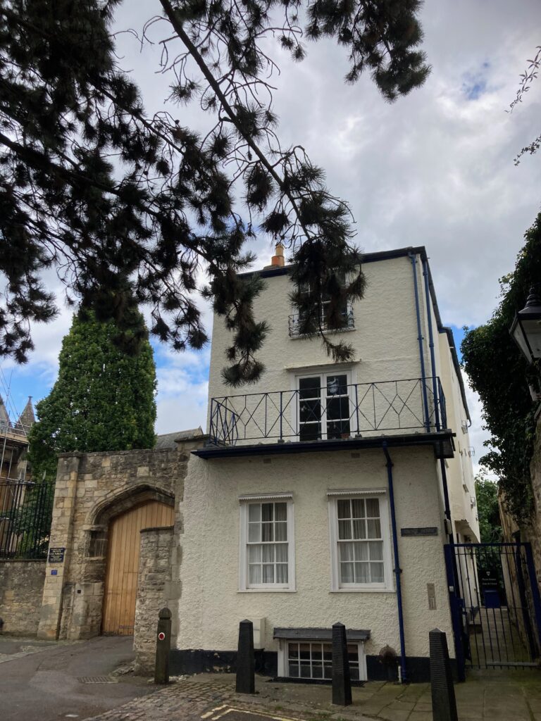
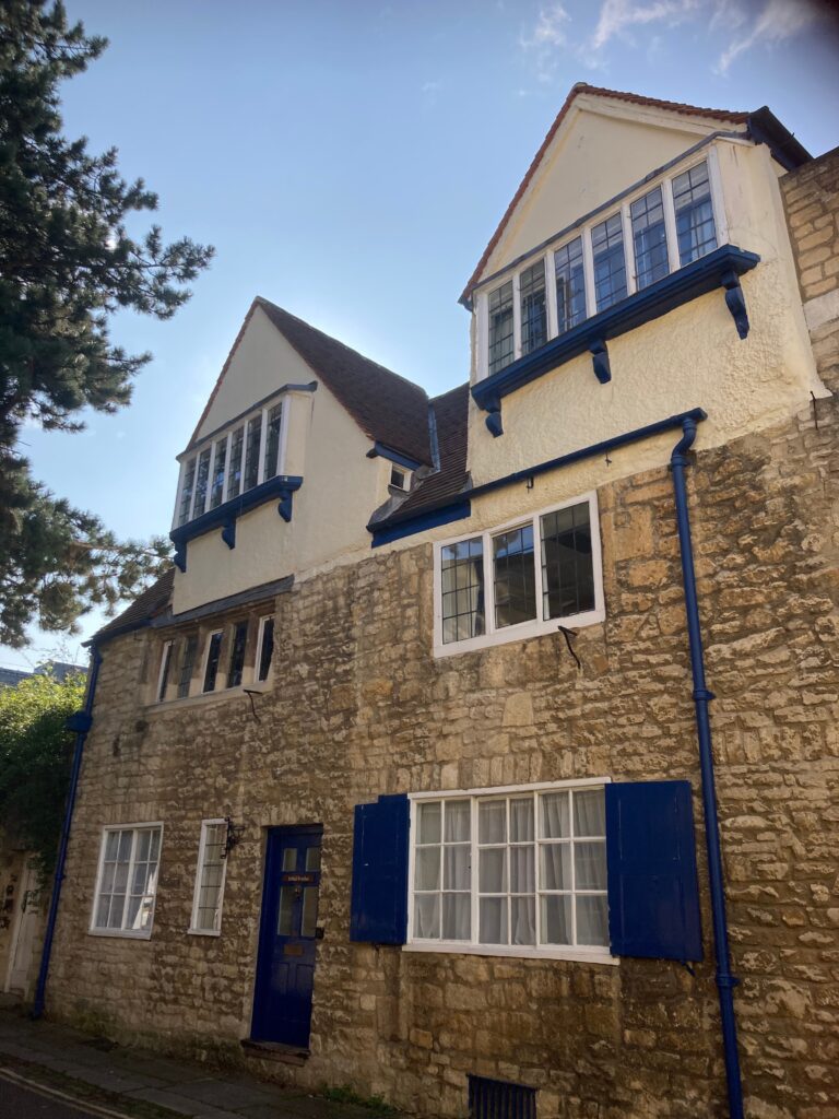
The wanton vandalism that saw the sad demise of The Crooked House pub near Dudley in the West Midlands, prompted a visit to one of Oxford’s own crooked dwellings. Thankfully still standing in a quiet cul de sac near the High Street, this pretty, two storey gabled Tudor building, has always intrigued me. Not just because of its wonky windows, slanting ceilings and lopsided landings – though I often wonder whether the Corpus Christ College students who now live here, might feel a little sea sick as their books and belongings slide from the sloping shelves. (The Dudley pub by the way tilts because it was under mined by the local colliery, in Oxford the reason is just age.)
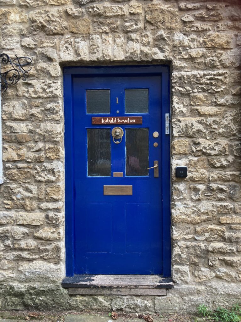
What I really delight in is its nomenclature. A letter addressed to this house would need no postcode by way of introduction. For the name emblazoned on its front door, Kybald Twychen, is the only one of its kind. ‘The house with the nicest name in Oxford,’ writes Dacre Balsdon in his book ‘Oxford Life’. I couldn’t agree more.
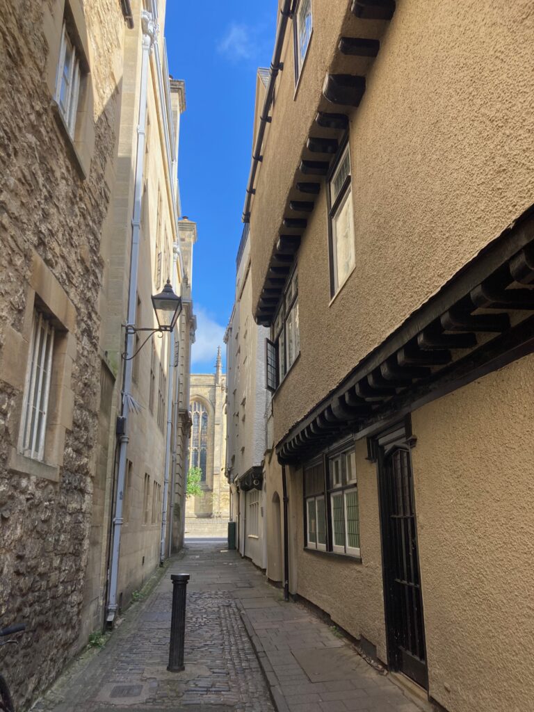
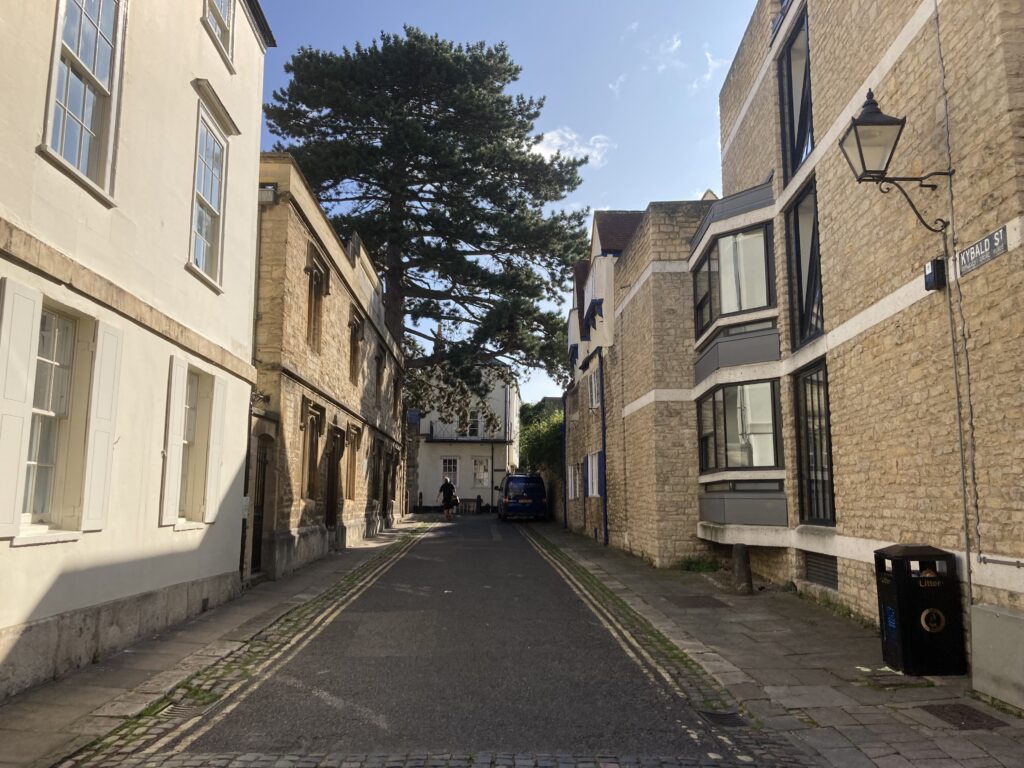
But then the names around here are all worthy of note. Kybald Twychen stands on Kybald Street, a place in what would have been the beating heart of the medieval University. It is sandwiched between Merton College and University College, both of which claim to be the oldest in the University and much of the cobbled streets, rubble-stone walls and narrow alleyways still remain. In the 13th century most students still lived in halls of which there were twelve on this street, when life was altogether noisier, and rougher than it is today. Violence often erupted. There are records of one student being killed in a brawl after a game of football in the street in 1303. And another of a man being lured to his death by a local grocer with a grudge.
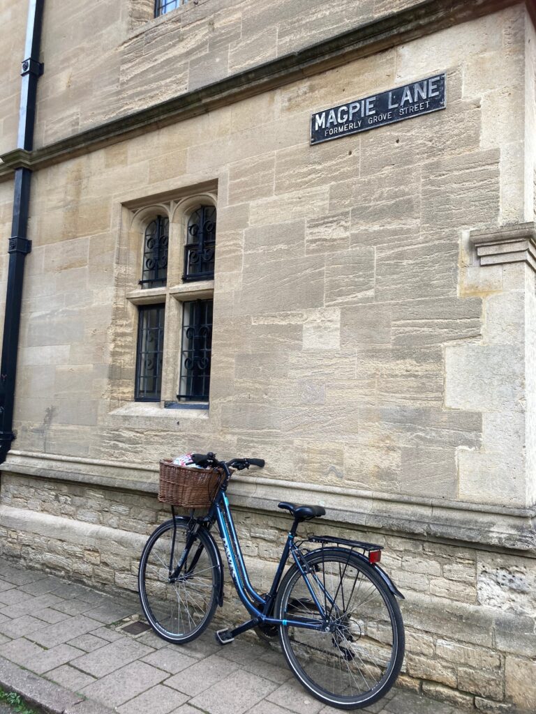
I make my way to the crooked house by turning south off the High Street into Magpie Lane, which gave its name to the title of a best selling thriller by Lucy Atkins. This narrow road, with overhanging timber framed houses on the south side, owes its present name to the 17th century pub that once traded at no. 5. But going way back to the 13th century it was known as Gropecunt Lane, and was the city’s main red light district. There were Gropecunt Lanes in many English market towns, though as sensibilities changed so did the name, (it has also been called Grove Street and Grape Street).
It was common for roads to be named after the economic activity that took place there. We have plenty of examples in Oxford. Fish Street (now St Aldates), Butcher’s Row (now Queen Street), Logic Lane (still exists as the place next to Aristotle House where philosophy fellows argued it out).
So where does the name Kybald Twychen hail from? Joanna McCunn, in her thorough, academic investigation in the Corpus Christi College publication, The Pelican, suggests ‘Twychen’ is simply an old English word for narrow thoroughfare; more specifically one that connects two different parishes. This makes sense. There is a stone around the corner that marks the boundary between the parishes of St John the Baptist in the south (no longer) and St Mary the Virgin in the north (very much present today). The parishioners of the latter can still be found whacking it with sticks every Ascension Day in an age old ceremony called ‘beating the bounds’ in which children especially, needed to be reminded in the days before maps, exactly where the limits of the parish jurisdiction and therefore responsibility ended. In other words if you are going to misbehave, do it away from home, so they didn’t have to pay for it.
Where the ‘Kybald’ part came from is a little trickier to explain. Built in the mid 1100’s the street was mapped long before the University arrived and would have stretched all the way to the city walls, sadly truncated over the course of many centuries to the stub it is today. McCunn offers up a few suggestions including an old English word for a type of cobble used as a possible road surface, or a cudgel, this being a likely place for cudgels to be manufactured. My favourite explanation is that it was named after Helen Kibald, the wife of one Roger the Spicer. We know he owned land around here in the 13th century and paid a pound of cumin every year for the privilege. Could it be an early example of first wave feminism? I like to think so.
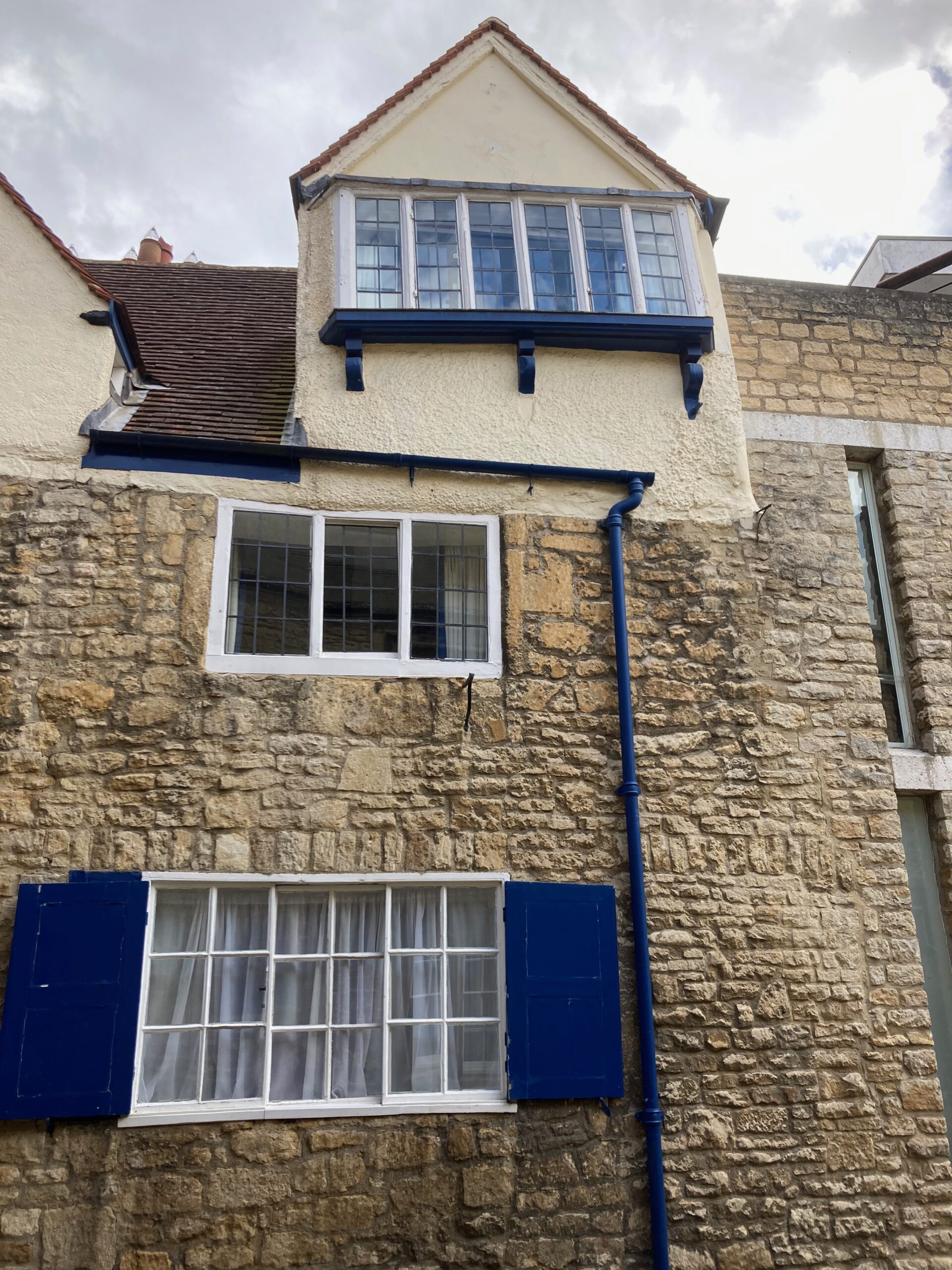
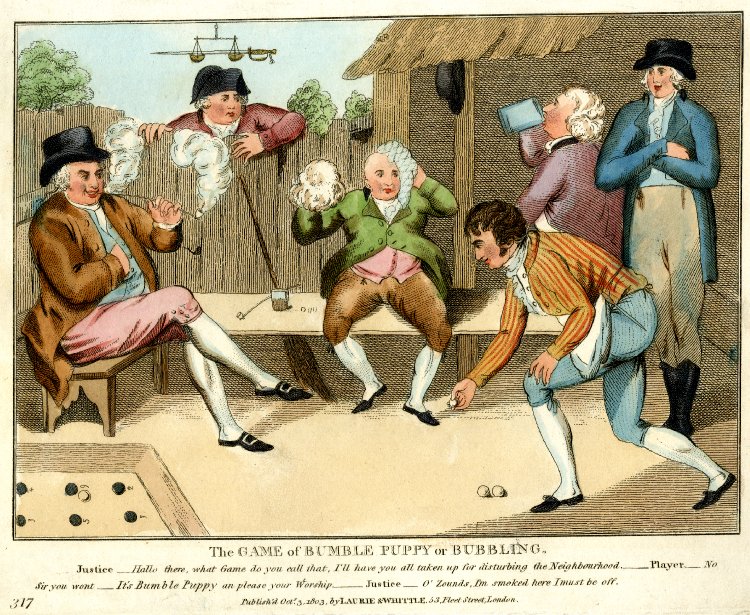
Whatever the answer, Kybald Twychen, the house that still stands, has been around since the late 16th century, and was almost certainly named as such from early days. It wasn’t until 1765 that an act of Parliament did away with house names and insisted that all new properties had a number and street name ‘for better identification’. It was first the Black Lion pub for Corpus Christi (colleges had their own alehouses then), and afterwards used as lodgings for its tutors and students. Its prime location and crooked demeanor, however, has made it ripe for redevelopment. Some say it was the discovery and restoration by a former fellow of a derelict pub skittle game ‘bumble puppy alley’ in the garden that saved it from the chop. In 1948 it was condemned by a city engineer ‘as a dangerous structure’ when its front wall fell down. In the 1960’s it survived the demolition of old houses to its west side and their replacement by flats of a more modern, upright and perpendicular nature.
But Oxford has taken this eccentric old building to its heart and now, with listed status, it will hopefully stand for many years to come, off the beaten track, a little gem of a place for those who know it is there. As I look up to its funny, misshapen roof line, against the blue sky of a late summer day, it feels like the place is moving, its walls creaking, pushing and shoving against each other, the cries of men and women echoing from below. Or maybe I am imagining it. For Kybald Twychen, the house with the lovely name still stands firm. And long may it remain. However crooked!
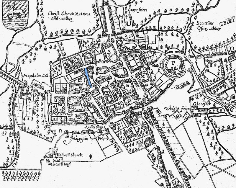
John Speed’s 1605 map of Oxford with Magpie Lane, then Gropecunt Lane, highlighted in blue. Kybald street heads to the East already truncated by then at Logic Lane. South is at the top, north at the bottom.
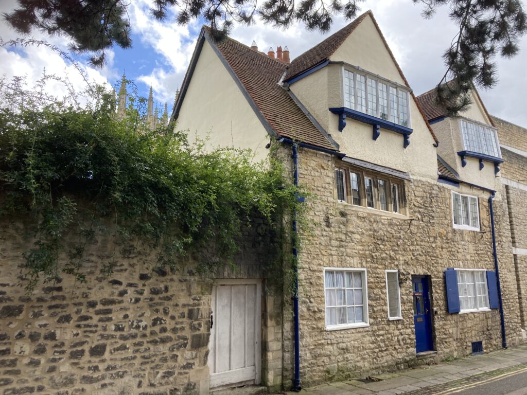
Kybald Twychen
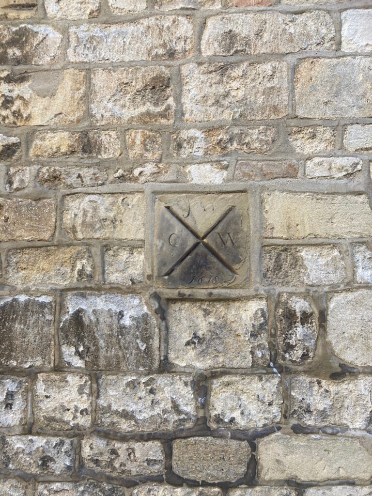
Parish boundary marker
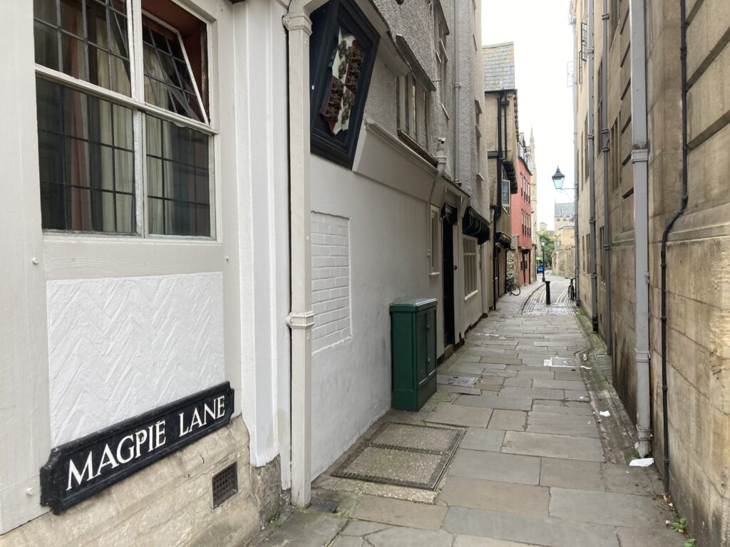
Magpie Lane looking south towards Merton Street
3 Comments
Join the discussion and tell us your opinion.
Fascinating. Another tasty Sausage.
Long live the crooked houses!
Magpie Lane in its previous incarnation gets into the OED!