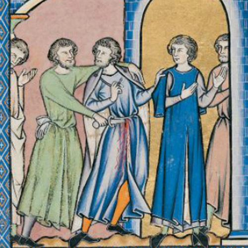
I am standing at the scene of a crime. Not far from The Oxford Sausage headquarters in front of the side entrance to The Ashmolean Museum on St Giles. It was roughly on this spot that the student, Robert de Brampwyth was found dead with a five-inch wound to the top of the head, so deep it pierced the brain. He’d, apparently had an altercation with two men the day before on the High Street, whereupon they followed him to his lodgings, drawn a sword and killed him. A case for Inspector Morse you might think.
Except that this murder took place on 7 March 1307. At a time when Oxford was the most dangerous place to live in the country. Five times more violent than both London and York, it had a murder rate of 70 to every 100,000 of population, that’s roughly the same as modern day La Paz in Mexico.
I know this because on my phone I have an interactive murder map of medieval Oxford. It’s been compiled by Professor Manuel Eisner, Director of the Institute of Criminology in Cambridge and his team, (they’ve already done London and York). And it’s brilliant. The map of 14th century Oxford comes courtesy of the Historic Towns Trust, and is easily recognisable to any 21st century local. There’s a smattering of colleges (Merton, Exeter, Queens, Oriel, University College are all here by then), many old churches remain, St Mary Magdalen, St Michael of the Northgate and the University Church of St Mary the Virgin among others, and there’s the castle to the west of the medieval wall that circumnavigates the town, with Carfax at its centre. Eisner has added tiny icons to this map representing murder weapons – swords, axes, staffs, bows and arrows, short knives the most frequent – placed on locations throughout the city. Click on one of these and up comes the story of the violent incident that happened on that spot. We have all heard of the big Town and Gown punch-ups, like the Scholastica Day Riots on 10 February 1355, after a dispute over the quality of the wine when over 90 people lost their lives. But here we have accounts of Oxford’s everyday street violence. Tales of butchers, bakers, and shoemakers but mostly students (referred to often as clerks) who argue about everything from urinating in the market to not liking their demeanour. With deadly consequences. Ironically it was the violence of Oxford residents that forced a group of academics to forsake the city entirely and set up the very place from which this study comes, Cambridge University.
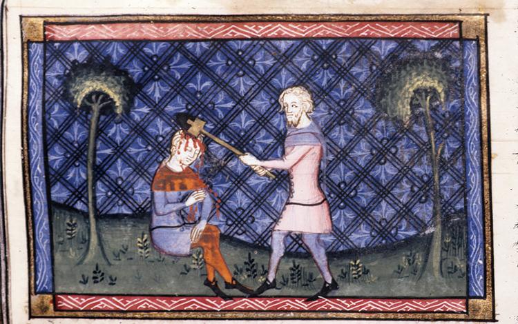
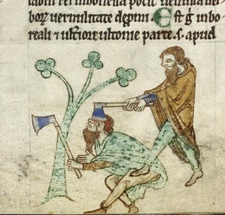
Take this case for example. I am now on Cornmarket opposite Boots. I click on the dagger marking this exact spot and up comes an account of the stabbing of the clerk, Gilbert de Foxlee, on 23 June 1306. A group of tailors and townsmen had been singing and making merry at the feast of St John the Baptist when heading out on to the street they come across Gilbert. With sword in hand and rather the worse for drink, he demands that they allow him to join their group. By their account the choir try to reason with Gilbert, but he is having none of it and starts to threaten them, shouting that he will cut off their hands if they don’t oblige. At this point they might have just let him be, but they too are carrying weapons. And they too have had a skinful. One stabs him in the right arm with a sword, another with a dagger in the back, while the rest of the crowd finish him off by hitting him about the head and thrusting a ‘sparth’ (fighting axe) into his left leg. Astonishingly he doesn’t die for another eight weeks.
All this information is drawn from the Coroner’s Rolls, bits of parchment written on, sewn together and then rolled up and kept in the Public Records Office. It was the coroner’s job (a royal official) to keep accounts of any suspicious deaths, and these unusually survive for Oxford for a short period of time in the early 14th century, just before the bubonic plague killed off a third of the town’s population. More than often, the accounts go like this. A body is found, the alarm is sounded (called ‘the hue and cry’ and it is just that) and the coroner is alerted. A jury of 12 men chosen from the nearest four parishes is then summoned and they try and piece together the train of events: the location and parish are specified, the date, time of day (dusk, vespers, after curfew for example), and nearest feast day (St Gregory the Pope in the case of Robert above). The wounds are described in forensic detail, (size and depth of abrasions and to which part of the body) as well as the weapons responsible for making them. Descriptions of the events surrounding the death are told by witnesses. And then if they think they have a suspect, he (it is always he) will be named and apprehended. That is if he hasn’t already fled under cover of darkness which was often.
I make my way on to the High Street and here the map is thick with armoury. Click on a short knife here or a sword there and it’s usually a case of a random dispute between scholars (this is where they lived most densely in unregulated halls), or students and townsfolk (students made up 1500 of a population of 7,000 at that time). It is said that there was more blood spilt between the city Church of St Martins (once on Carfax of which only the tower remains) and the University Church of St Mary the Virgin (half-way down the High Street) than on most battlefields.
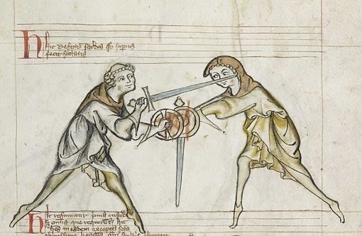
Professor Eisner reckons the reasons for this were many. Here was a large community of young men aged between 12 and 21 (the most risk-taking and violent section of society to this day) away from home for the first time. Easy access to drink, (most crimes were committed near taverns on a Sunday, the equivalent of our Friday night,) and weapons, (sharp knives were commonly carried to cut food and axes to chop wood stood in many hallways) was unlikely to produce a hippie style love-in. North – South animosity between students was rife (north including Scotland and south including Wales and Ireland). As were arguments between tradesmen who resented the growing power of the University, and students, all clerics, protected by church law and so rarely prosecuted. Even when they were caught, the worst punishment, that I could find alluded to was exile.
It’s funny how addictive all this stuff is. I suppose it explains the popularity of the crime novel and voyeuristic allure of a Jack the Ripper tour. But after a while it gets a little overwhelming and rather depressing. I decide to visit one last site on Catte Street, a spot just outside where Hertford College now stands. A short knife marked in red is one of only two on the map that show that the murders are of women. There are no female perpetrators. On 27 April 1299, Margery de Hereford, a sex worker is struck in the left breast by a (supposedly celibate as they are all clerics) student who refuses to pay her what she is owed. She dies. No attempt is made to find the man who killed her or bring him to justice. I sigh and head home.
To do your own tour visit the website where you can also find medieval murder maps of London and York:
https://www.cam.ac.uk/stories/medieval-murder-maps
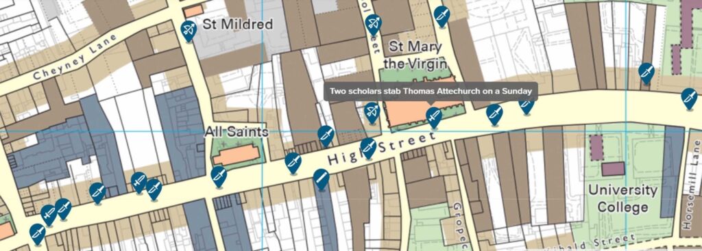
A small section from The Medieval Murder map of Oxford made by ©The Institute of Criminology at The University of Cambridge.
2 Comments
Join the discussion and tell us your opinion.
Sensational sausage this week. So interesting. If a little gruesome….
Wow! I can see why this is depressing (especially the no attempt to find the killer of poor Margery). But so intriguing, nevertheless, for understanding the social and class tensions of the period. The images are especially gruesome and vivid. So glad Oxford has nixed at least this tradition!